Caledonian – EL8920 (100% SKY)
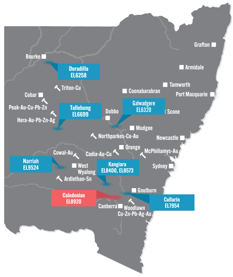
The Caledonian Project is located 20km south-east of Yass in the Southern Tablelands of New South Wales. The area comprises volcanosedimentary rocks of the Silurian Douro Group and is considered prospective for gold mineralisation.
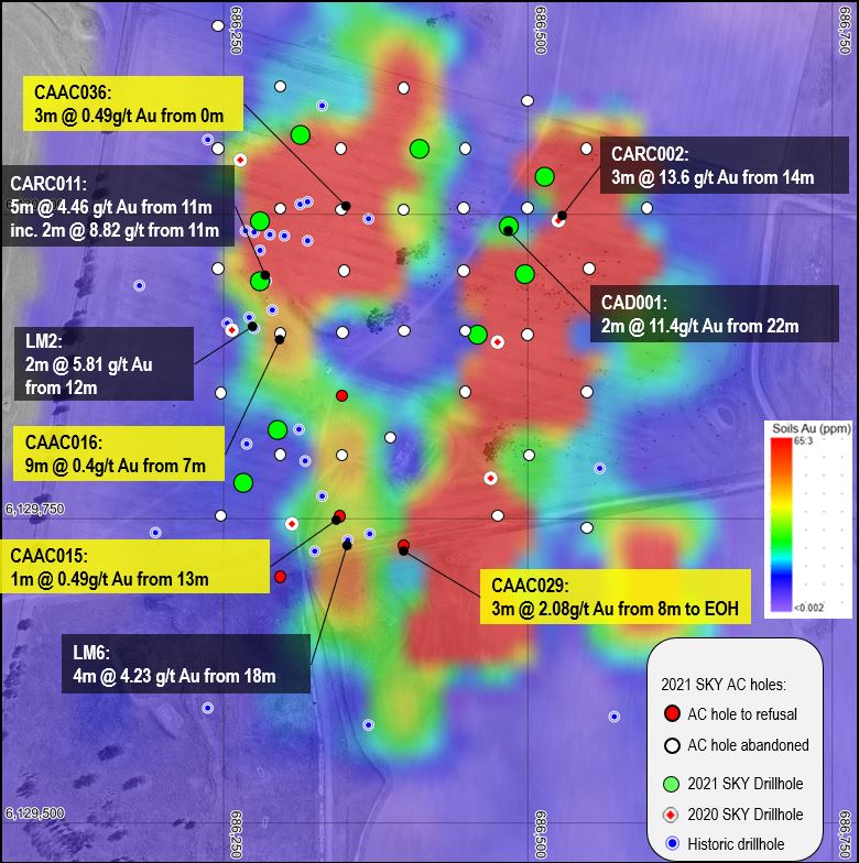
At the Caledonian Prospect, historic gold results from previous exploration include 36m @ 1.2 g/t Au from 0m to EOH in drillhole LM2 and 81m @ 0.87g/t Au in a costean. The distribution of multiple historic drill intersections indicates a potentially large, mineralised gold zone with discrete high-grade zones, e.g. 6m @ 8g /t Au recorded from lode at historic Caledonian Mines (GSNSW). A strong, robust soil gold anomaly (600 x 100m @ +0.1ppm) occurs and most historic drillholes are shallow (less than 25m deep) and terminate in gold mineralisation.
SKY has now completed a soil sampling program, a phase of AC drilling, two phases of RC drilling and two diamond drill holes at the Caledonian Target. A review of SKY’s results and historic results indicates the Caledonian gold mineralisation likely represents a shallow, sub-horizontal blanket of oxide and supergene gold mineralisation developed over an oxidised gold-rich skarn.